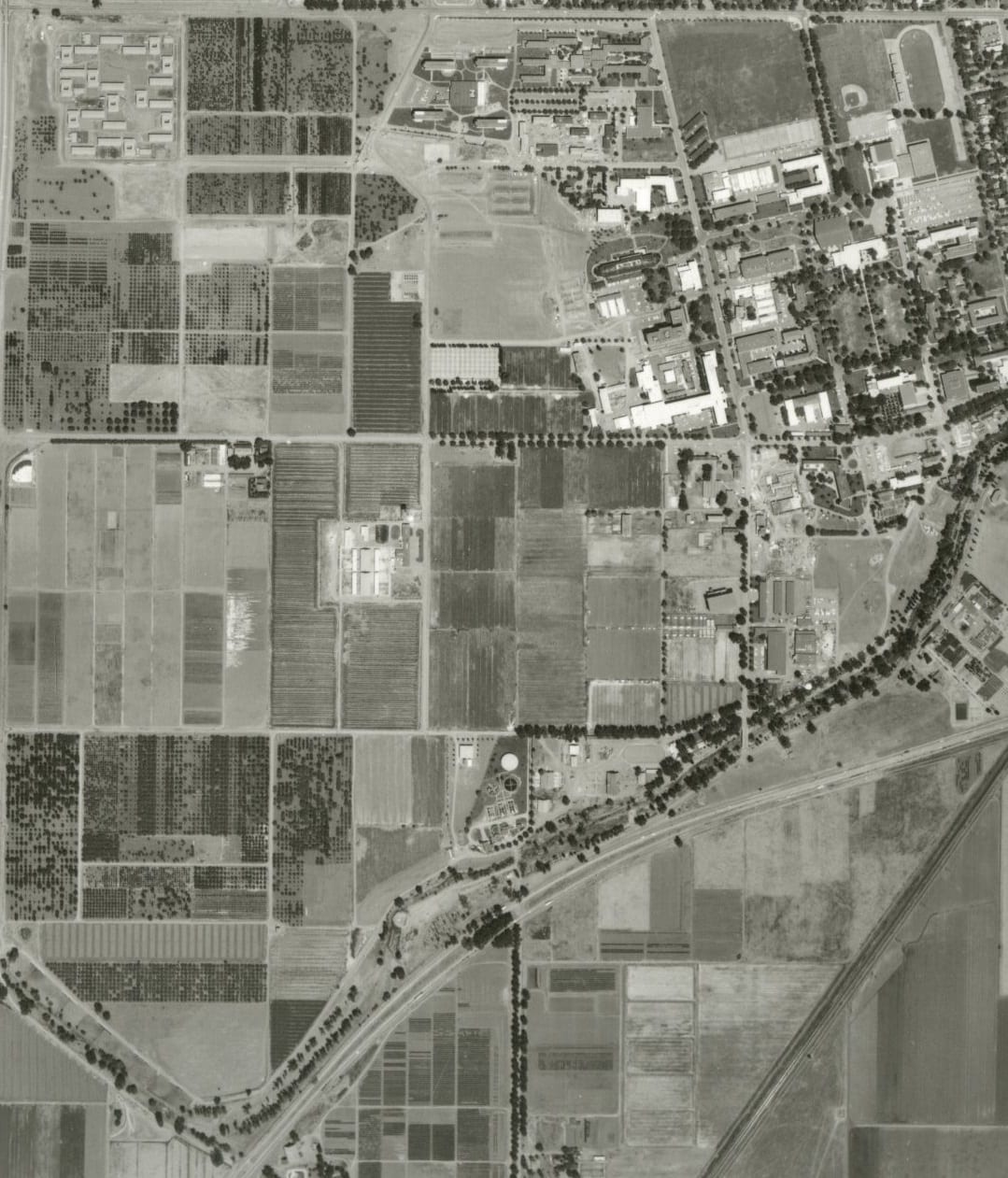
UC Davis, 1937. Call Number: G4364.Y6A4 1937 .U6; Photograph Number: ABB 61-4
50 Features of Special Collections: Aerial Photographs
Aerial photographs provide some of the most visually impacting research materials in the Map Collection. Combined with USGS topographic maps and other maps available in the collection, research can often be enhanced with aerial photography dating back to 1937 in the Central Valley. Often used for statements of environmental impact, remote-sensing materials can show how land has changed, how urban development has increased, and how water has been redirected. Aerial photographs have also helped people resolve legal boundary disputes, and a scanned image of an aerial photograph of a farmhouse which was purchased by a student’s family in 1937 was once used as a Christmas gift to that student’s father.
When doing research of one location over many decades, it is often best to start with the most recent materials available and work backwards in time. The more recent aerial photographs have familiar landmarks, such as freeways, urban built-up areas, water ways, and reservoirs. However, many of these landmarks begin to change or disappear as you go back in time. Interestingly, railways behave in the opposite manner. Railways were more prevalent in the early to mid-20th century, and some have disappeared in the newer photographs. Airports are still in the same locations that they were in 1937, but most commercial and military airports have added additional runways to accommodate increased air traffic.
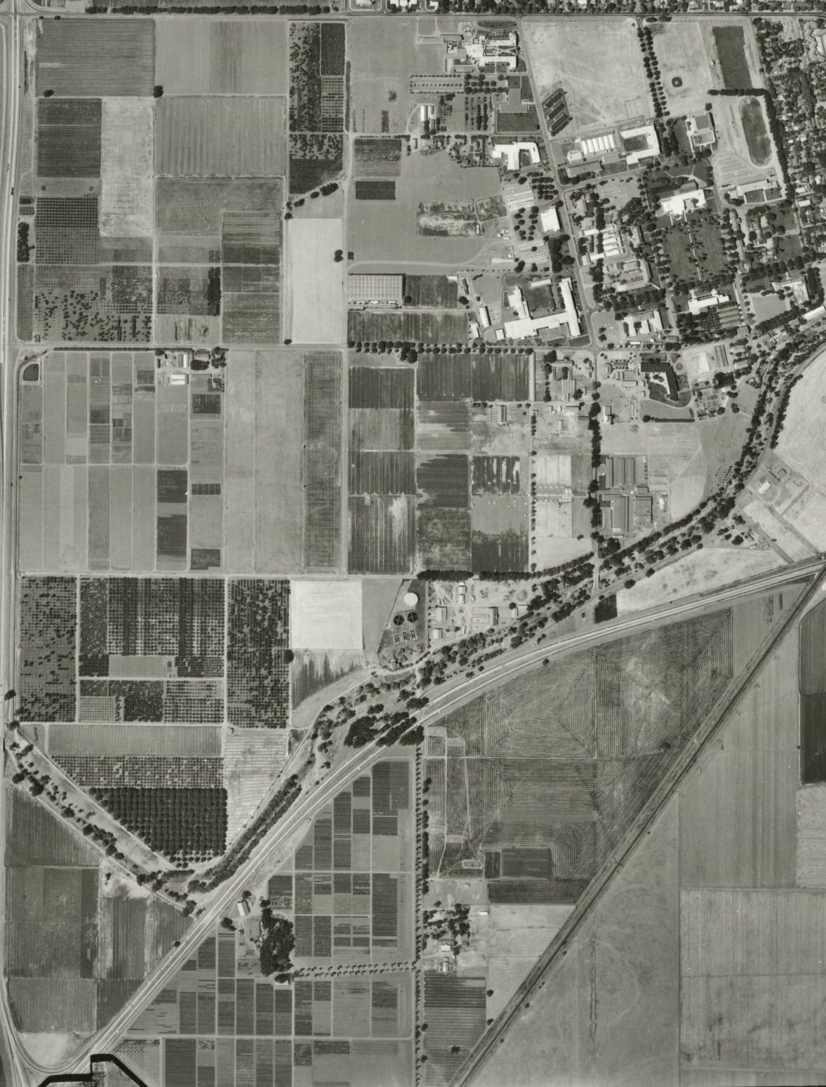
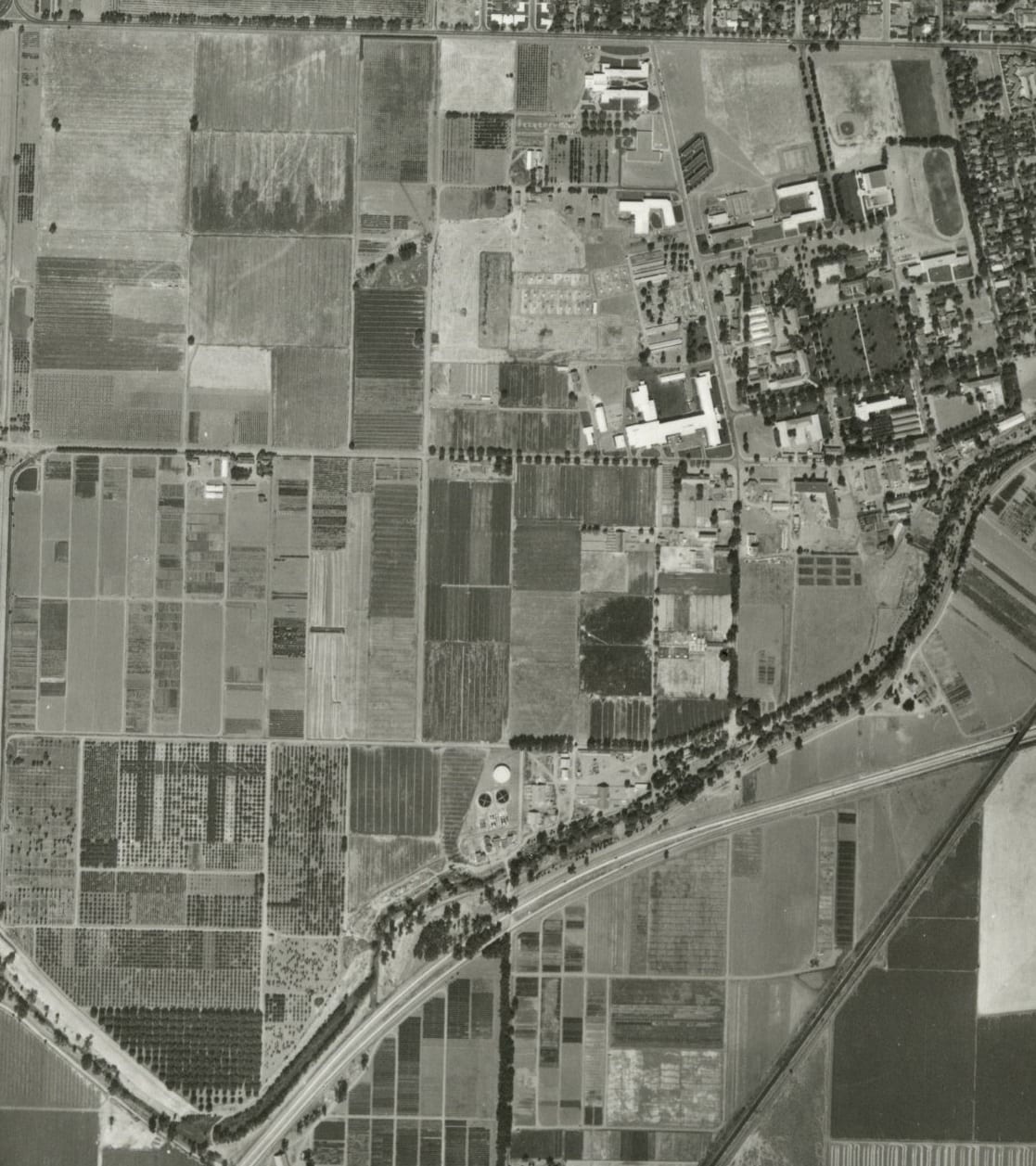
The following examples of aerial photographs show the main portion of the UC Davis campus–the north boundary at Russell Blvd, the south boundary at Putah Creek, the east boundary at A Street, and the west boundary at Hwy 113.
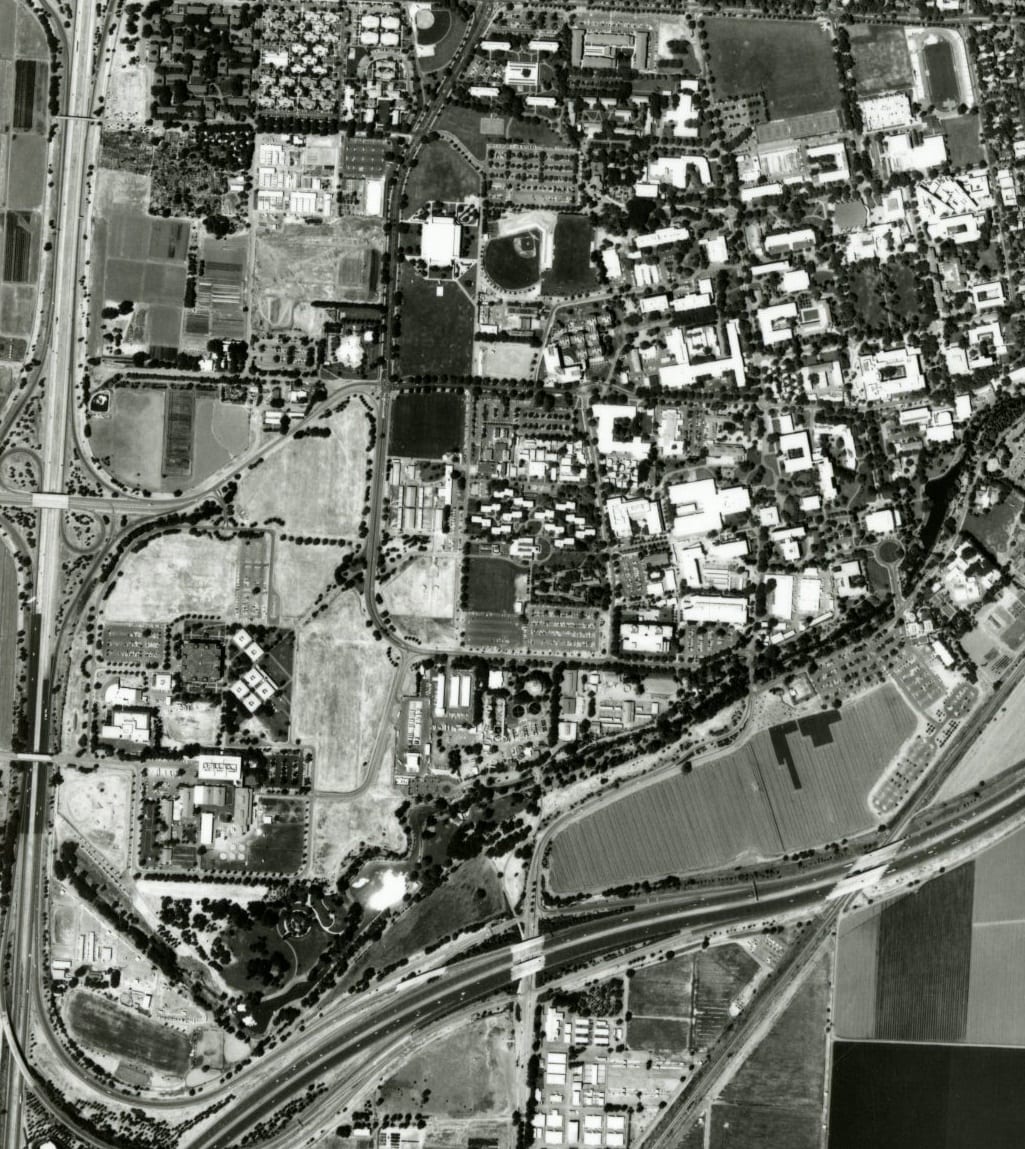
UC Davis, 1999. Call Number: G4364.Y6A4 1999 .W2; Photograph Number: WAC-99CA 4-186
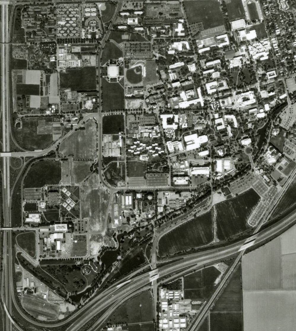
UC Davis, 1996. Call Number: G4364.Y6A4 1996 .W2; Photograph Number: WAC-96CA 9-140
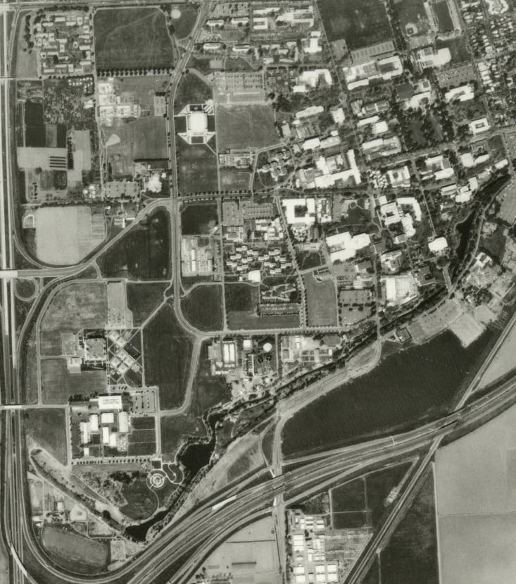
UC Davis, 1984. Call Number: G4364.Y6A4 1984 .W2; Photograph Number: WAC-84C 3-51
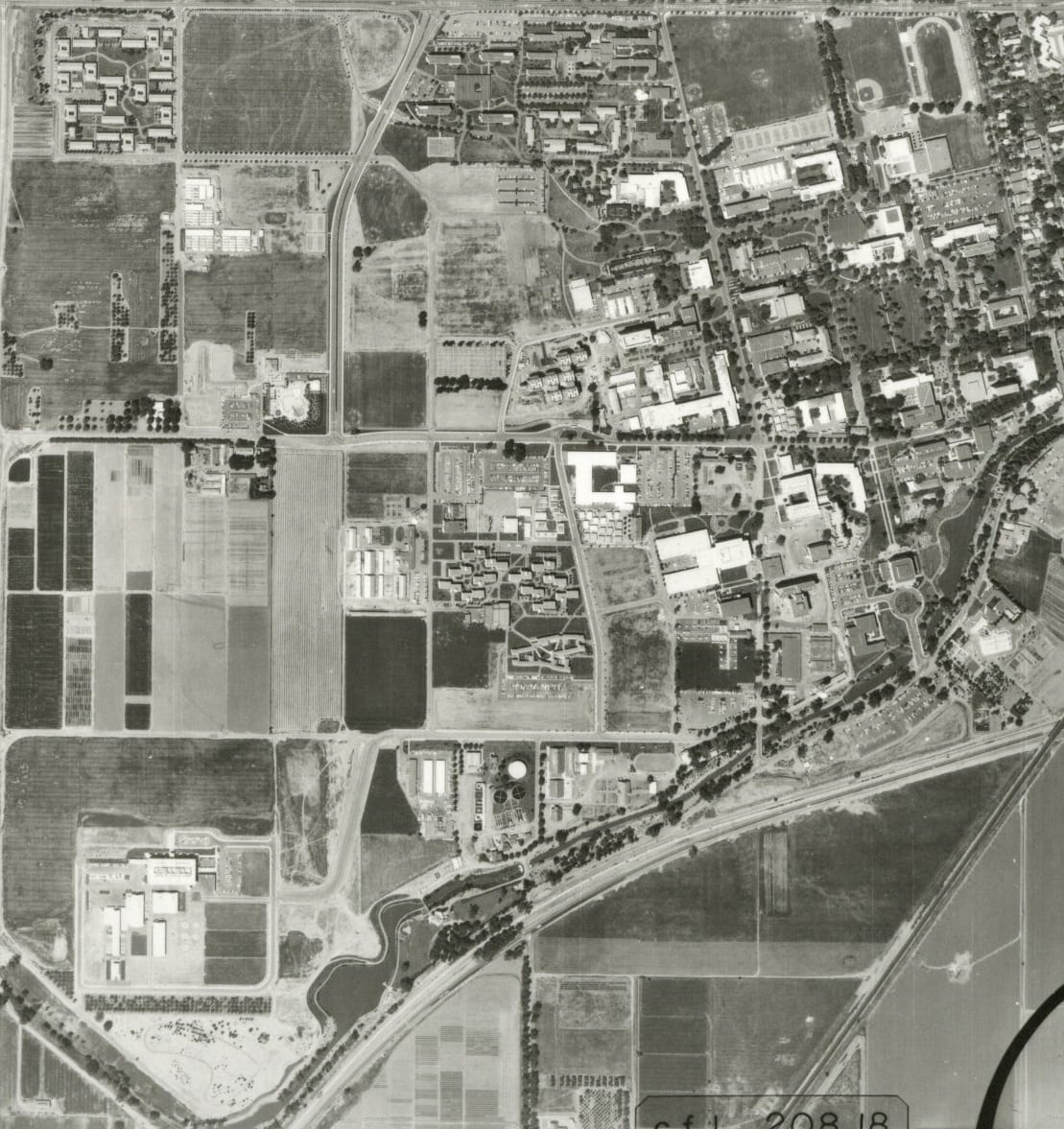
UC Davis, 1971. Call Number: G4364.Y6A4 1971 .U6; Photograph Number: ABB 1MM-205
UC Davis, 1964. Call Number: G4364.Y6A4 1964 .U61; Photograph Number: ABB 3EE-106
UC Davis, 1957. Call Number: G4364.Y6A4 1957 .U61; Photograph Number: ABB 41T-112
UC Davis, 1952. Call Number: G4364.Y6A4 1952 .U6; Photograph Number: ABB 3K-34

UC Davis, 1937. Call Number: G4364.Y6A4 1937 .U6; Photograph Number: ABB 61-4
An index showing aerial photographs for counties of California available in the Map Collection is on the Library’s website:
https://library.ucdavis.edu/guide/ucd-aerial-photo-holdings-county/.
You can view these photographs and many others in the Map Collection at UC Davis. The Map Collection is located on the lower level of Shields Library and is open from 1pm to 5pm Monday through Friday during the academic quarter. To see the most accurate schedule for the Map Collection please visit this link: https://library.ucdavis.edu/guide/maps/#hours-2.
Post created by Dawn Collings and Kristoffer Landes.