Special Collections, Maps
50 Features of Special Collections: Early Oil Fields of Kern County, California
28/50
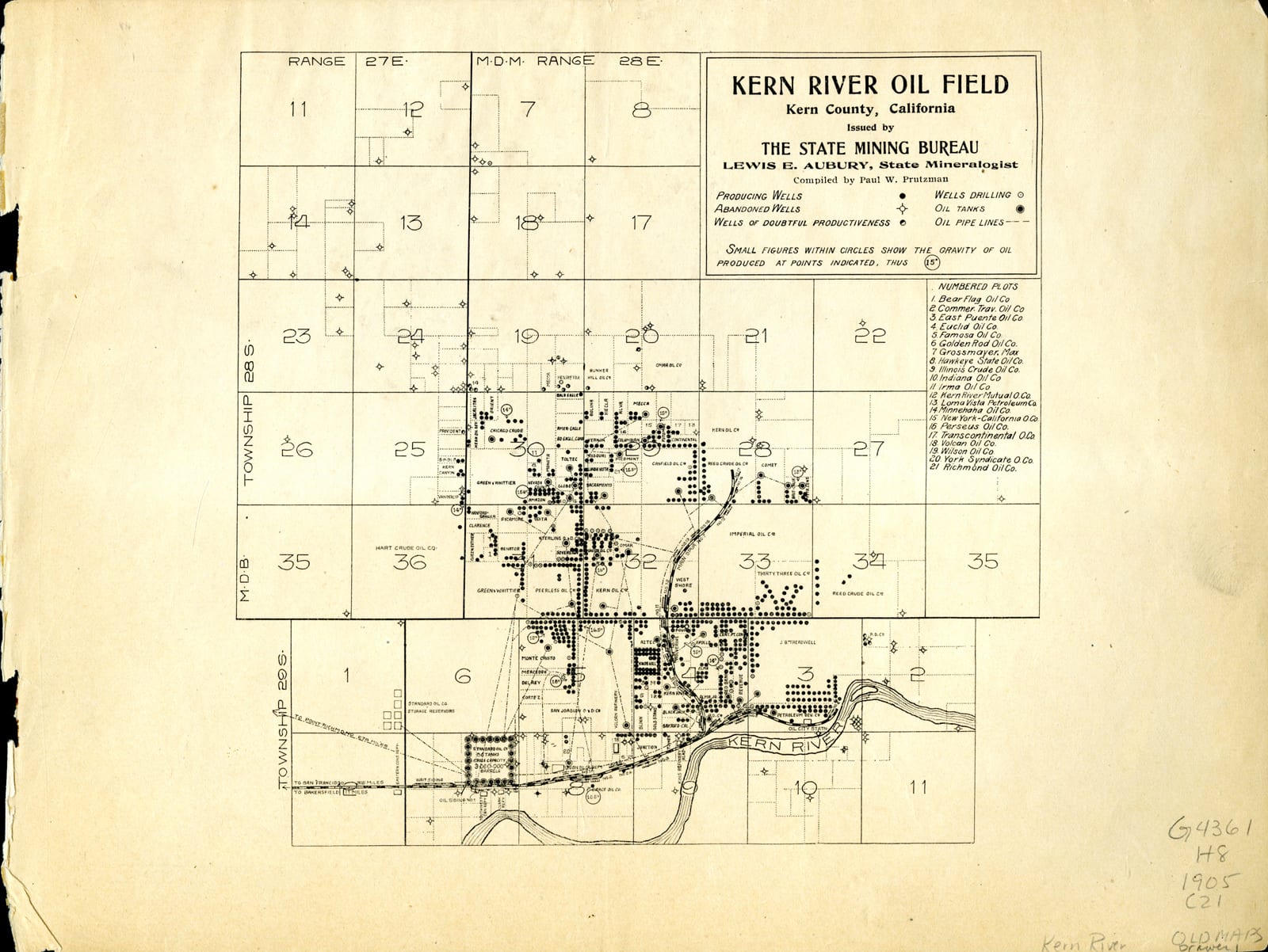
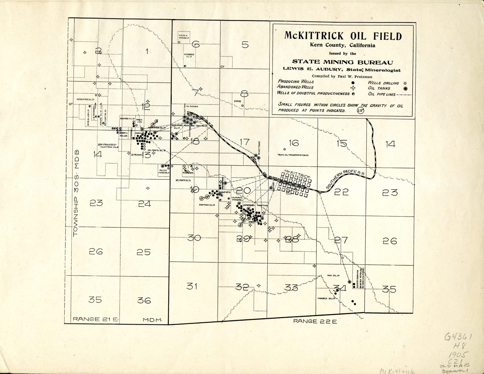
Beginning in 1864, tar was mined in open pits for asphalt and kerosene in the Kern County region. After the discovery of the Shamrock Gusher at the McKittrick Oil Field in 1896, oil wells began to replace tar mining as the predominant form of energy harvesting in California.
The Midway Gusher at the Midway Oil Field blew in 1909 and was followed shortly thereafter by the Lakeview Gusher on March 14th, 1910. To date, the Lakeview Gusher remains the largest gusher to have erupted in the United States and is immortalized as California Historical Landmark 485.
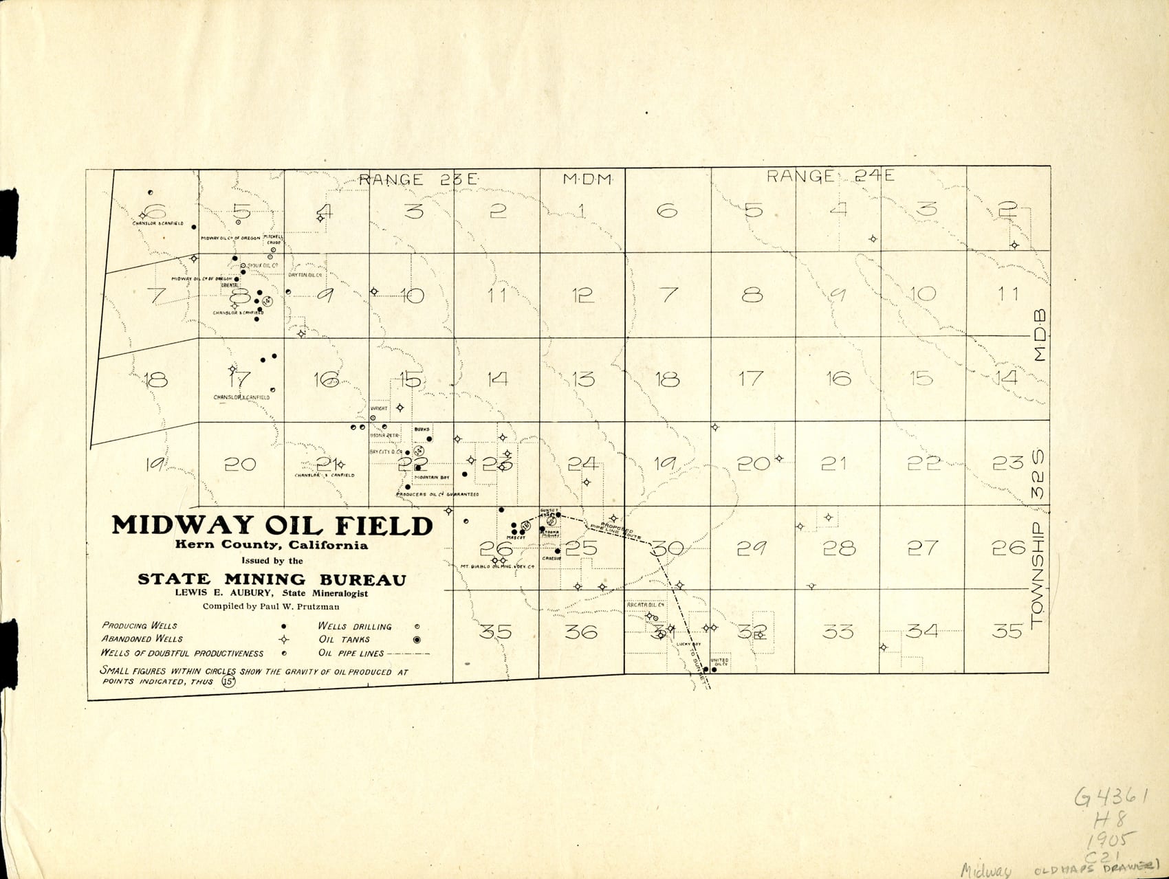
All of the oil fields showcased in the maps above are still in active use, although the Midway Oil Field shown here in this 1905 map is now part of the larger Midway-Sunset Oil Field. The 2015 Report of California Oil and Gas Production Statistics published by the California Department of Conservation gives detailed statistics regarding how many barrels of oil were produced by each field in 2015:
- Kern River: 25,693,327 barrels
- McKittrick: 3,334,448 barrels
- Midway-Sunset: 28,184,793 barrels
Further examination of the report reveals that the Kern River and Midway-Sunset oil fields were the top two California oil fields in 2015, followed in third place by the South Belridge Oil Field, which produced 22,901,979 barrels. Together, the Kern River and Midway-Sunset oil fields accounted for approximately 26.7% of the state’s 201,711,080 barrel total, lending credence to the claim that these historic fields are still a critical part of California’s natural resource industry today.
For more information on the history of oil in Kern County please visit these websites:
http://www.sjvgeology.org/history/
https://en.wikipedia.org/wiki/Kern_River_Oil_Field
https://en.wikipedia.org/wiki/Midway-Sunset_Oil_Field
Resources:
California Department of Conservation, 2015 Report of California Oil and Gas Production Statistics, April, 2015, ftp://ftp.consrv.ca.gov/pub/oil/annual_reports/2015/PR03_2015.pdf. Accessed 25 Jan. 2017
California. Office of Historic Preservation. California Historical Landmarks. 11th Ed.]. ed. Sacramento: Office of Historic Preservation, Dept. of Parks and Recreation, 1990. Print.
Prutzman, Paul W. [Kern County Oil Fields]. Sacramento, CA?: State Mining Bureau, 1905. Print. (MAP G4361.H8 1905 .C21)
Post created by Dawn Collings & Kristoffer Landes